< Back
£10.00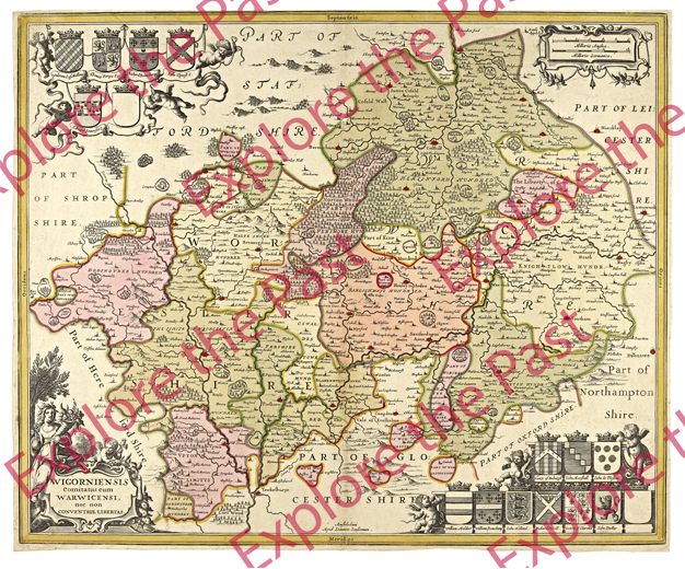
- Category:
- Maps and Plans
- Accession No:
- 899:31 BA3672/8
- Dimensions:
- 8935 x 7425 pixels (744 x 618 mm at 300DPI)
- File Size:
- 90.61 MB
Jan Jansson’s 1646 Map of Worcestershire. This high quality digital copy was produced by Worcestershire Archive and Archaeology Service Digitisation. It is supplied in a JPEG image file, delivered as a digital download. If you would prefer a different format please contact the Digitisation Service.
Copyright clearance for publication is not required, except in the case of documents in third-party copyright. In addition to this, reproduction fees are payable for commercial use and direct reproduction of our images. Please contact us to discuss if you are considering publishing.
Got a question about purchasing an image? Check out our frequently asked questions for answers to some common queries.
