< Back
£10.00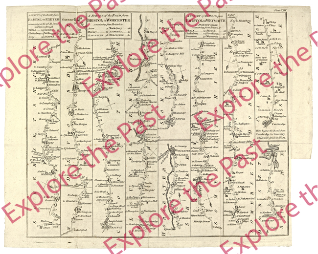
- Category:
- Maps and Plans
- Accession No:
- 899:31 BA3672/10
- Dimensions:
- 9732 x 7780 pixels (811 x 648 mm at 300DPI)
- File Size:
- 85.04 MB
Ogilby Road Map 1675, showing routes from Bristol to Worcester, Exeter and Weymouth. This high quality digital copy was produced by Worcestershire Archive and Archaeology Service Digitisation. It is supplied in a JPEG image file, delivered as a digital download. If you would prefer a different format please contact the Digitisation Service.
Copyright clearance for publication is not required, except in the case of documents in third-party copyright. In addition to this, reproduction fees are payable for commercial use and direct reproduction of our images. Please contact us to discuss if you are considering publishing.
Got a question about purchasing an image? Check out our frequently asked questions for answers to some common queries.
