Family activity: Build a scrap map
- 27th April 2020
Why not build a scrap map?
Whilst at home, why not make a map of your local area, you can draw it, paint it, or make it out of scrap material
You are here!
When you talk about a map you may think of the layout of a large shop, a map for walking or driving, an online map or a world map or globe, depending on your age or interest.
You might be out and ask someone for directions to somewhere and you are told “Go down the road for a minute and turn left by “the lights”, then right by the park then go until you see the church on the right …” – that too is a map too isn’t it?
The big image at the top shows different sorts of maps. These are to give you ideas of what you might put on your own map.
Think about what you can use around the house to draw a map and maybe make buildings, trees, mountains or hills out of household things like old cardboard boxes, wrapping paper, twigs from the garden (they would be good to show trees) and remember to ask a grown up if it is ok to use them.
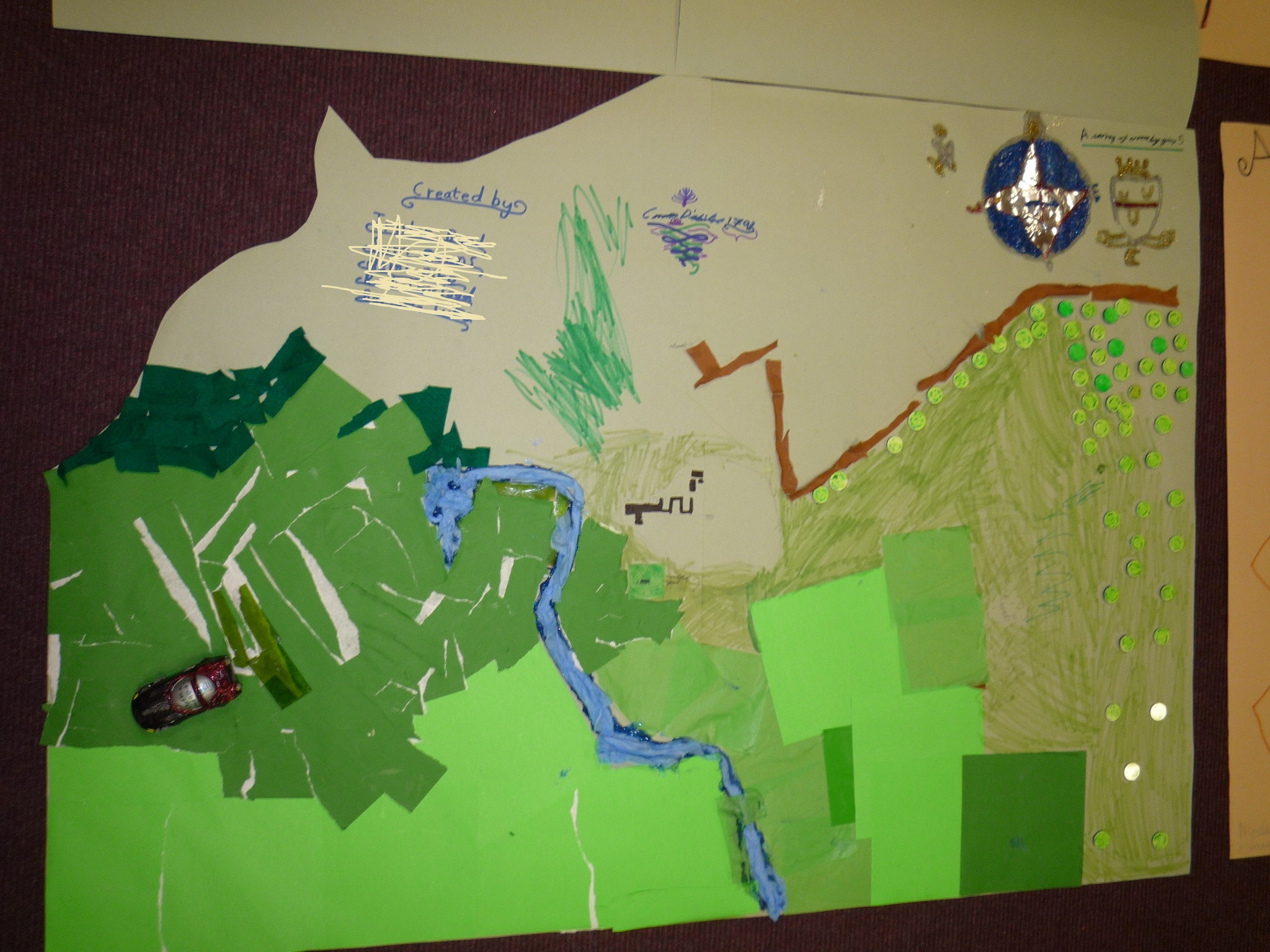
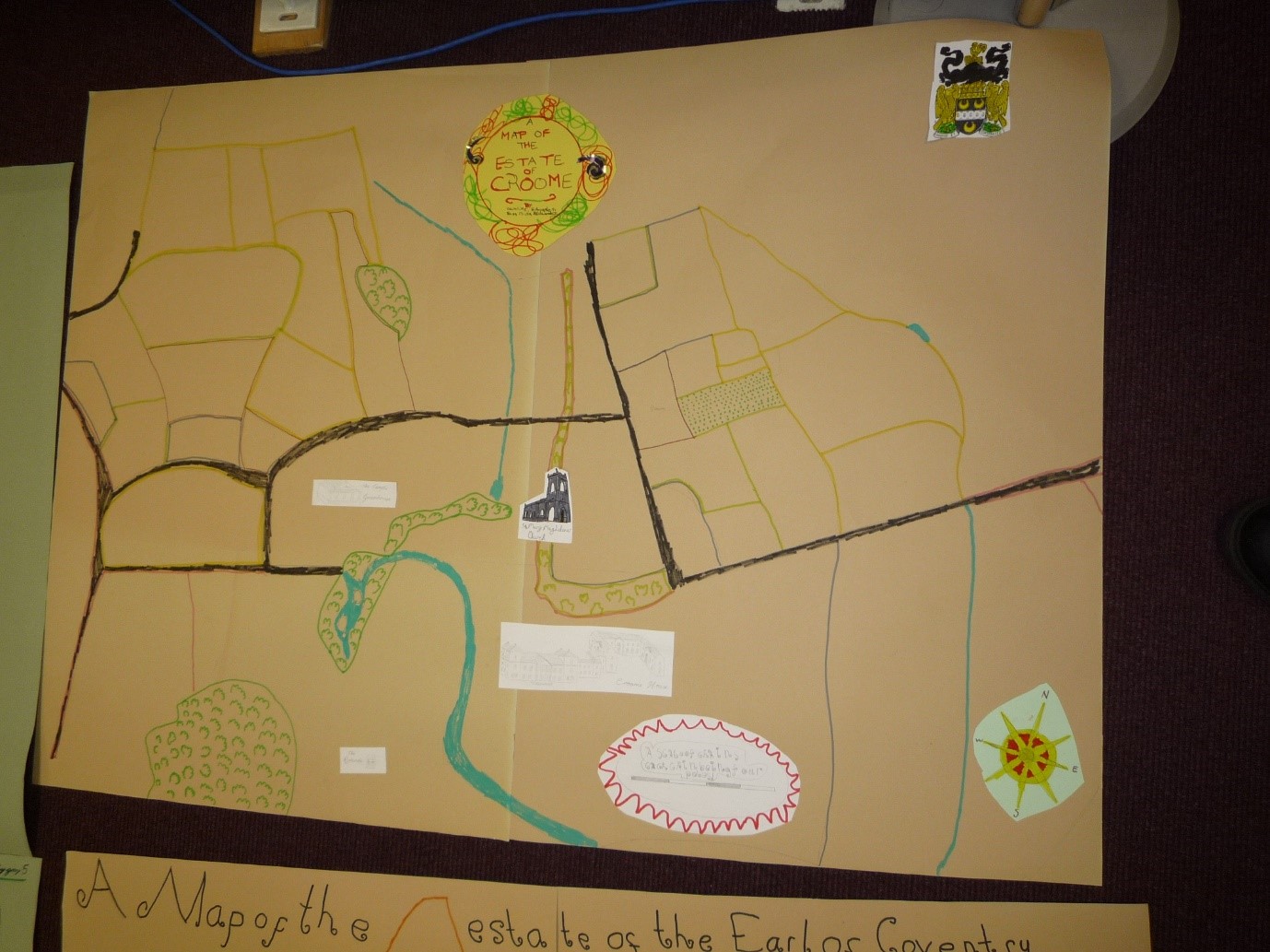
Map of Croome Estate created by members of Worcestershire Young Archaeologists Club
What do I include?
If you were to create a map what might you have on it?
While you are limited in getting out at the moment, think about what is important to you or what places and buildings you remember about a journey or even just looking around a room or building.
- Would it be of your trip to the shops or school so you might have things like churches, shops, roads, road crossings and parks?
- Perhaps a treasure map?
- Maybe a map of the kitchen and where different foods, plates or cutlery are stored. You could use labels from fruit drinks, tins milk on a picture of the fridge. Or you might use labels from peanut butter and marmalade (hmmm) and you might even make a kitchen door out of a piece of cardboard box that is already folded and windows from an envelope with a plastic window?
If you follow the link below, you will see a map of the city of Worcester. You can use it to find where you live and zoom in and out by clicking on the “ + ” or “ – “, in the top right, so you can see your area.
OpenStreepMap of Worcester
What would you choose? How would you show the buildings, trees and other things? That is up to you.
Some maps are black and white, some are very colourful. Some maps even look like models so for your map you could use things like a twig to make a tree with green paper for the leaves.
Please be careful about what you use – always ask permission. It may be best to get a grown-up to help cut things out if you need to, or help glue them to your map.
At the end of this we will show you some examples of different maps to inspire you.
Different styles of maps
Maps that you may be used to seeing have different places (perhaps countries, cities, towns or buildings) connected by black lines for roads, blue lines for rivers or streams, green shapes for parks or forests and blue shapes for ponds or lakes. Lines in shapes are used to show borders like those around Worcestershire or showing an area of land owned by a farmer, or the outline of a house.
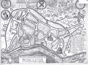
Below is a 1610 map of Worcester – the first map of Worcester, that was measured by pacing the area. It is quite small and have a look at how churches and houses are drawn. Not just little boxes but like you were next to them. Can you see the lovely details like the plough and horse on the right?
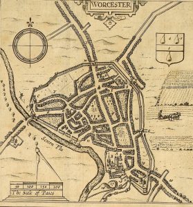
May by John Speed of Worcester 1610.
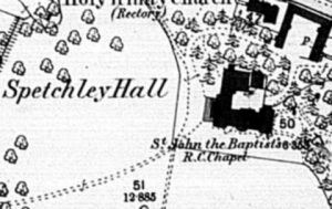
Some maps need more detail and in the 19th century the army got involved because they were used to making maps like that, and they created the map below. See there are no fancy buildings or horses and it is in black and white. Below this is a map of Spetchley from the 1880 1st edition Ordnance Survey map and it is very factual.
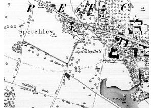 |
Can you see how they have used special little pictures for trees, and how buildings are drawn to roughly the right size. Some building names are written beside, them like St. John the Baptist’s R.C.Chapel.
|
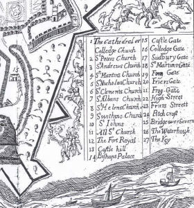
Another way of showing important places and buildings was used in the map below. It is a map of the defences of Worcester at the time of Battle of Worcester in 1651. You can see that not only are trees and gardens marked, but ships on the river and battles in the fields outside the city walls.
 |
Important buildings have numbers next to them and a key on the right of the map
|
How will you let people know what a special place is?
Would you write the name next to the place, or put a number next to it and write a table of places on the map or do something else?
Maps can be coloured in
We have seen that some maps show the outline of a building, a bird’s eye view, while others show buildings side on to show what it looks like as they do in the map below.
It’s up to you what you do on your map!
Here are some maps drawn with buildings side on and coloured in really carefully.
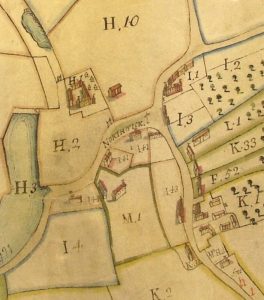
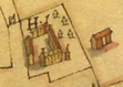
| This is part of a map of Claines from around 1730.
You can see how on this one they have drawn buildings side-on and coloured them in.
|
 |
Map decoration became very popular for showing off what land was owned. This colourful map from 1623 shows part of the Croome Estate collection and was land owned by the Earls of Coventry.
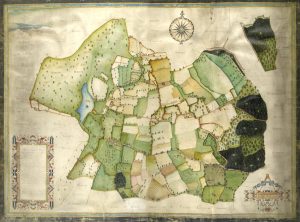 |
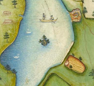 This close-up portion of the maps shows the boating lake and lovely pictures of people at work and swans as well as buildings. This close-up portion of the maps shows the boating lake and lovely pictures of people at work and swans as well as buildings.
It looks good but this must have taken a long time to do. |
Another example of a pretty map is this one from the Vernon Map Book of 1731-2.
This part of the map illustrates Shrawley Woods and shows land owned by Bowater Vernon of Hanbury Hall.
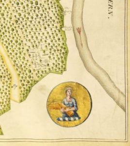 |
Can you see the lovely pictures of a cheerful farmworker with arms full of straw? Above her are little pictures of workers in the woods. 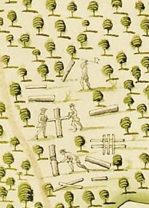 |
So, what is your map going to look like?
You don’t have to have a large estate, or own a village, or even be at war to draw a map.
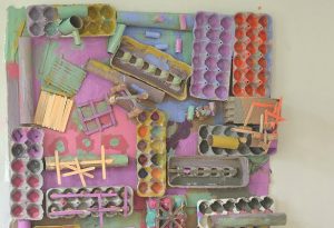
Why not draw, or paint, or build a map – or use all these techniques on the same map?
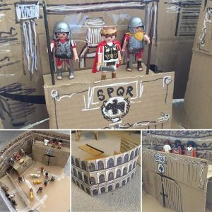
You could build a map of the Colosseum in Rome (this one thanks to friends of the Service) …
Perhaps you could include shops as well?
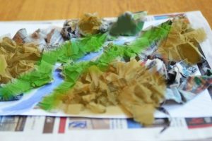
Or imagine a trip up the River Severn just as the Romans might have seen it?
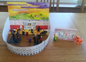
Perhaps create a map of an archaeological site?
Whatever you want to put on your map, or however you create it, please do it safely (ask permission from an adult and ask them to help cut or paint or glue things).
Whether it is a map of a bedroom, garden, a local park, school or imaginary place, make it a map of things that are important to you.
Why not take pictures of your scrap map and write a few words about it for us?

Post a Comment