Online Resources: Tithe Map GIS Website
- 23rd April 2020
Please note this guidance is out of date. You can find the new tithe map website at Explore The Past .
Maps are always popular, partly because of how they look, but also the information they contain. Modern technology makes it easier to use that information, including being able to show it in pictorial form.
This week’s online resource is the Worcestershire Maps website, which features Tithe maps from across the county digitised and put into a GIS (Geographical Information System) format so that they can be overlaid on a modern map with the names and details associated linked to the relevant fields. This means that you can use this in all sorts of ways to see who owned/rented land, what it was called, and see land use over a wider area, amongst other things.
By visiting the website you can zoom into to an area and search out information from the 1840s (and sometimes earlier) for particular fields and pieces of land.
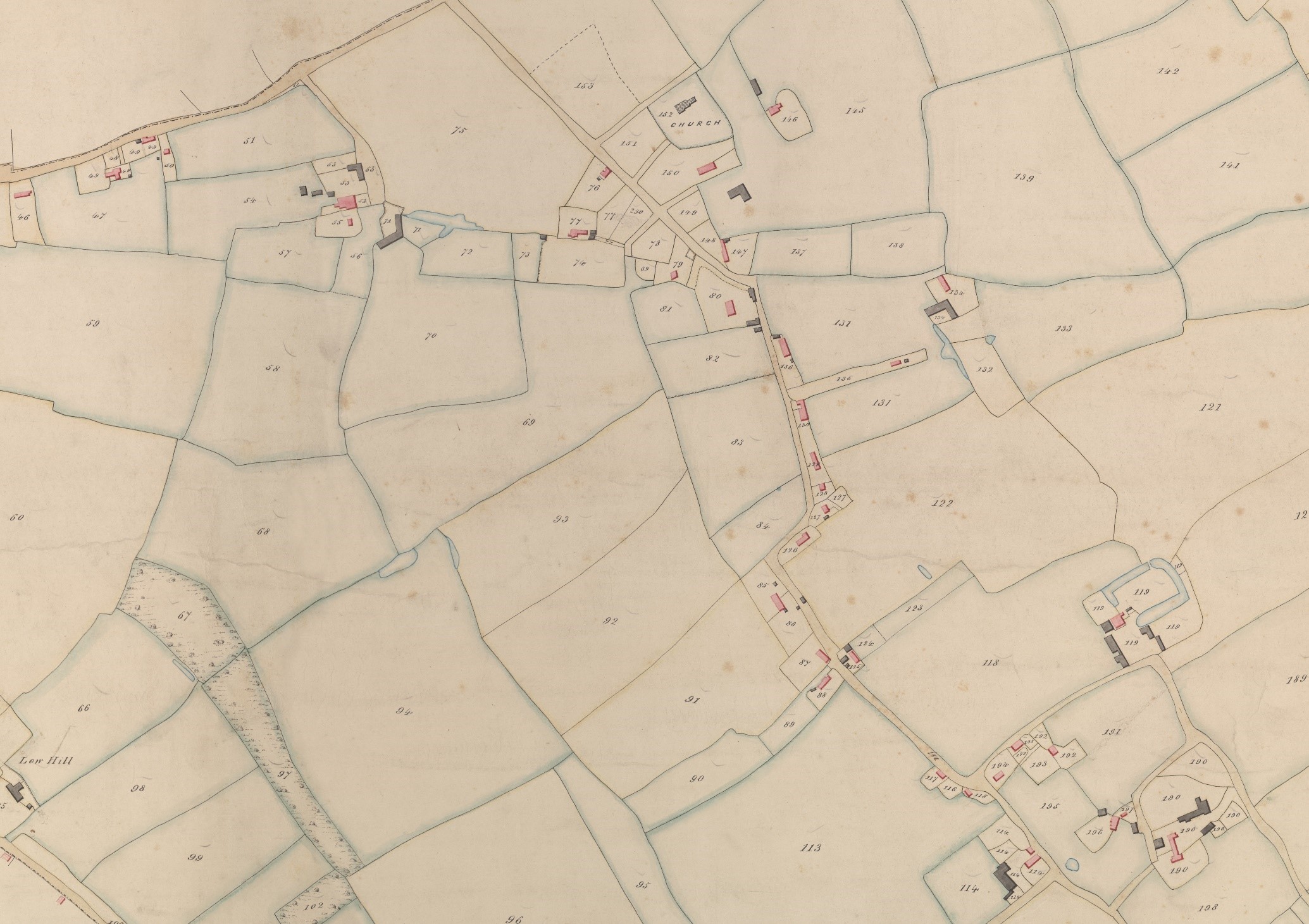
The website had its origins many years ago. Tithe maps, and other maps too, have always been useful to archaeologists. Sometimes they are the earliest maps for a particular area, but also because of the details contained in the apportionment, the written list which went alongside the map. Landowner, tenant, land use and name of land was included on the document which were created in the early 1840s to work out the new fixed amount people would pay in theory to the Church, but often the Lord of the Manor who’d then say they’d use the money to upkeep the church. Land names can be helpful for working out the history of a site, for instance Brick Kiln Field or Mill Field can give clues. Land Use is also useful for landscape archaeologists.
Tithe maps, held in the archives, are very big, and often very fragile, so the archaeologists were looking at ways to make them more accessible. David Guyatt was a long standing volunteer for us, and in 1991 Hal Dalwood asked David to trace 1:10,000 scale Ordnance Survey maps and then add on the field names from Tithe Maps. Many hours were spent in the Record Office and it was completed in 2006, providing an incredible resource which is still available.
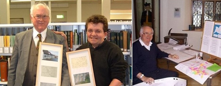
David Guyatt & Hal Dalwood
With advancement in technology it was realised than this information could be linked to digital maps on computer and the information manipulated and interrogated to provide new insights. The Historic Environment Record was now map based with GIS, so it was suggested that Tithe map data could be added as a new layer, alongside other historic mapping and the HER. We had developed these skills so could easily add these maps.
Digitising the maps, adding the information and linking to modern maps cost money so we worked with local groups on Heritage Lottery Fund projects which paid for this work for their parish(es) as well as running community projects. Only a portion of the county could be covered before that particular HLF funding stream ended, but we managed to get quite a bit done. A couple of larger projects, such as Grow With Wyre, arranged for several parishes to be digitised.
Although mostly Tithe maps were covered we also included a few Estate maps (maps commissioned by landowners) and Enclosure (drawn up when land was Enclosed to show how it would look). For instance, the 1731 map of Claines was included as part of Worcestershire Young Archaeologist Club’s Northwick Project, and it also paid for the conservation of the map.
The result is that there is now a lot of data on there. You can choose whether you want it the show land owner, tenant or land use, and as it is colour coded you can see patterns across a swathe of land to show land ownership or land use across a wider area, which is easier to spot in this way than in written text. There are also thousands of names, and the archaeologists suddenly were contacted by family historians who came across their ancestors.
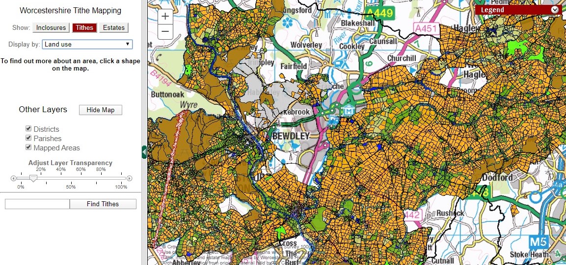
To use the website go to https://gis.worcestershire.gov.uk/website/explorethepast/. Zoom into the area you’re interested in.
Find out whether the map is Tithe, Enclosure or Estate.
Select what the colour code will relate to – ownership, tenant or land use.
Land colour coded by land use
Click on a piece of land and the relevant information will come up.
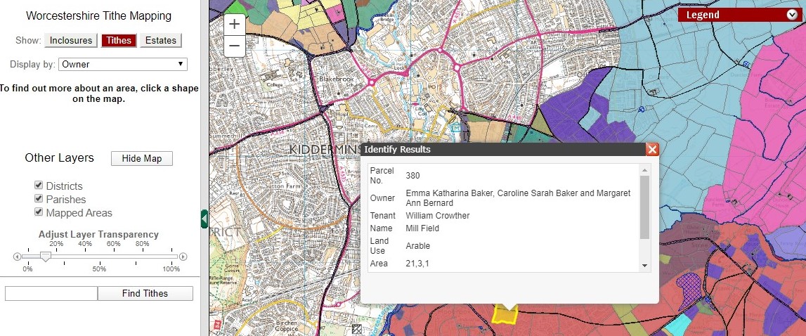
Details of Mill Field
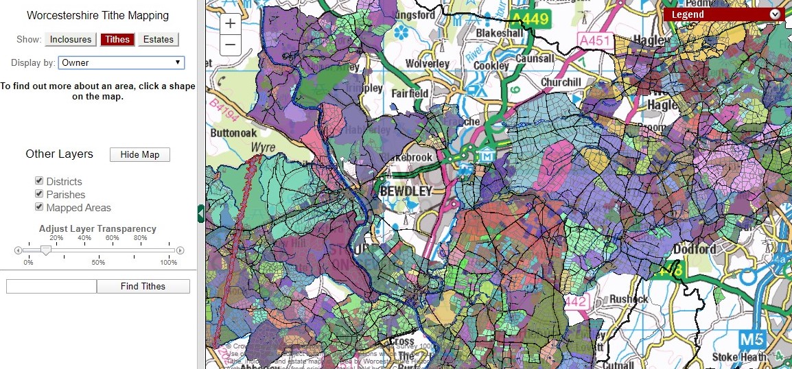
Map colour coded for ownership, seeing how land ownership was grouped
Have a play and see what you can find!
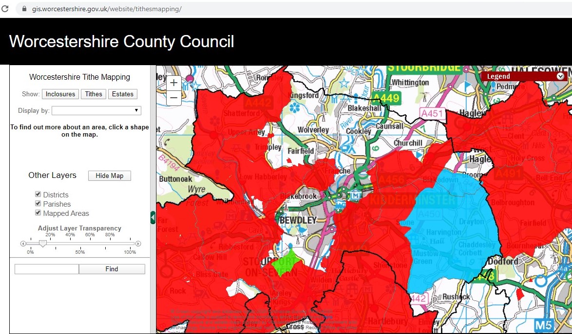
Not all of Worcestershire has been covered. Original Tithe (and Enclose and Estate) maps are in the archives, although most Tithe and Enclosure maps are viewed firstly on CD which is easier and allows good quality prints to be made. The apportionments (written records) have been typed into Excel spreadsheets by Peter Walker and are now on CD too, published by Worcestershire Historical Society.
Tithe Map of White Ladies Aston
If you are interested in looking into whether your parish could be included in future, and would be interested in a joint project, please let us know.

Post a Comment