Updated Map and Plans Index
- 17th June 2021
While we have been closed to visitors, staff have been working hard during the past year to make more of our archives available to researchers working remotely.
We have been working on updating our Maps and Plans Index and have created a new searchable database that will replace the existing one on our website.
You can search by parish, or village, however now you can search by date and see each individual entry chronologically.
To view the work that has been undertaken go to Our Collections page and click on the date range you are interested in.
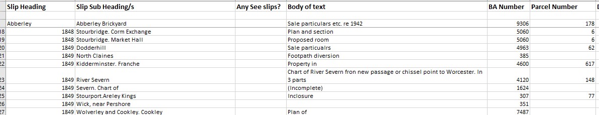
Example
We hold an extensive collection of printed and manuscript maps and plans relating to Worcestershire and the surrounding area dating from 1564 to the late 20st century. Maps and plans make an appearance in many of our collections. For example those generated by local Government or by the rail companies or created on behalf of local families. They all play their part in recording the development of the county and city.
The Historic Environment Record also has a large range of digital maps, along with aerial photos and LiDAR.
Highlights include
Maps created by J. Doharty Senior and Junior
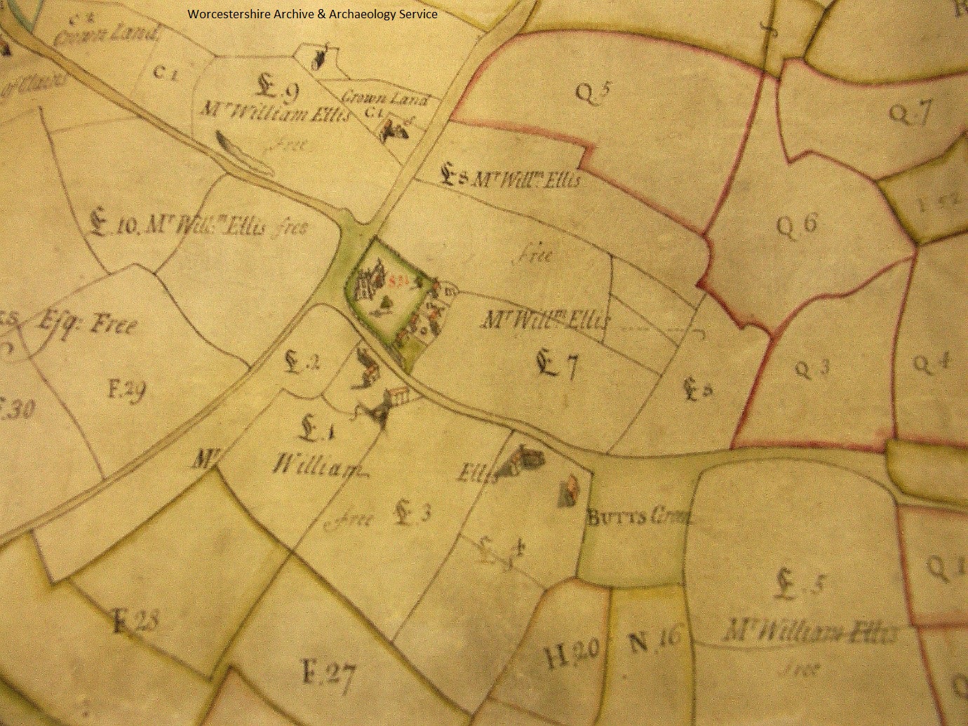
Doharty map of Claines, 1751, showing Claines Church
Croome Estate maps
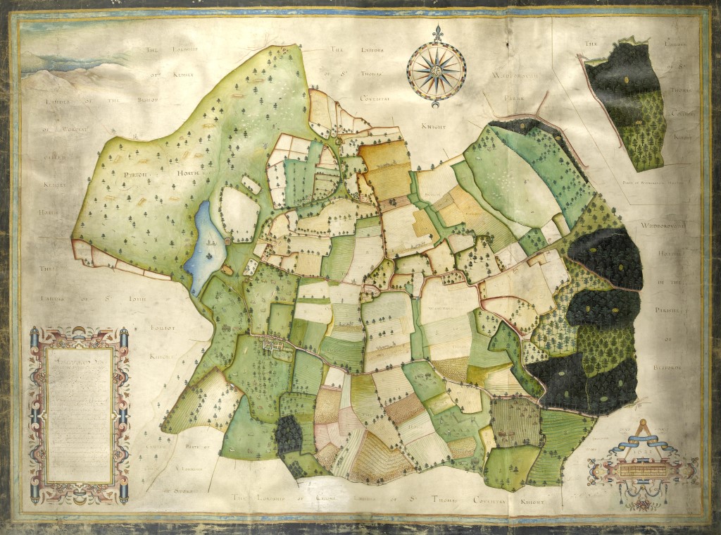
Pirton map of 1621, part of the Croome Estate Collection
Snape map of the Croome Estate
Vernon Estate maps
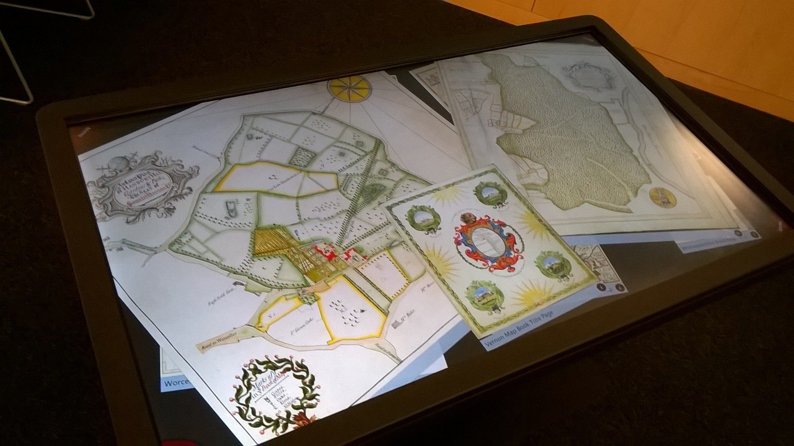
Pages from the Vernon Map Book shown on the Digital Touch Table
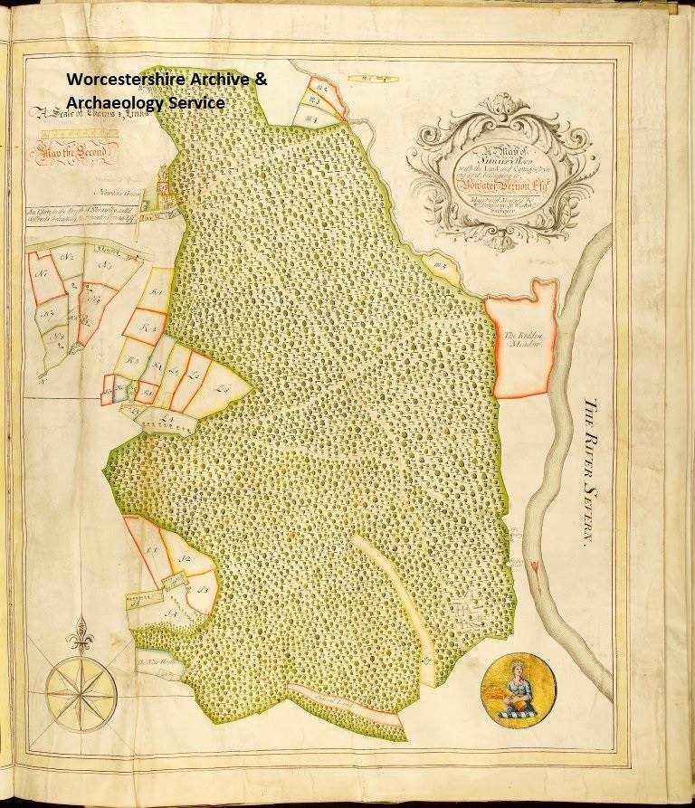
Shrawley Wood as shown in the Vernon Map Book 1731-2
Bishopric and Dean and Chapter Estates
We are constantly looking to develop our collections, looking for ways to make them more accessible and this past year has made us realise just how important this work is.
So, continuing from this, with the help of volunteers we are hoping to create a database of our entire collections index. Watch out for more information on this exciting project.
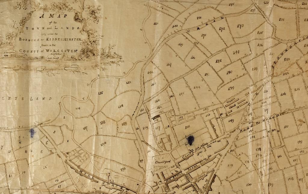
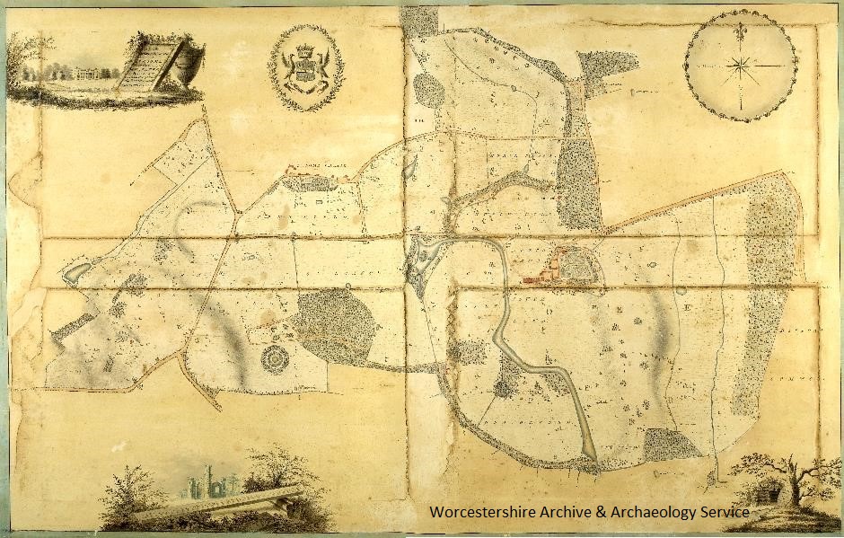
1780 Kidderminster map
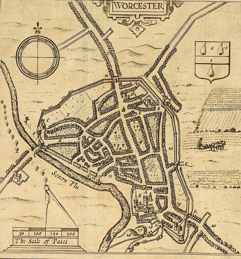
John Speed Map of Worcester 1610.

Post a Comment