Preserving the past as part of a sustainable future
- 30th April 2025
WAAS work in partnership with the Forestry Commission to enhance the historic environment evidence-base for woodland creation proposals in Worcestershire
The government is committed to increasing tree and woodland cover in the UK from 14.5% (in 2023) to 16.5% (by 2050). Diverse, resilient woodland habitats play an important role in tackling climate change through carbon capture and storage and natural flood management. Woodland ecosystems are vital for biodiversity and can support a wide variety of wildlife, including protected species, and can provide a sustainable source of timber for building material, fuel, and more.
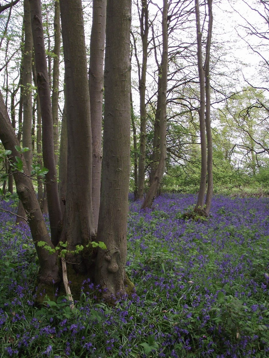
Mature lime coppice, Thurlby, Lincolnshire © Forestry Commission 2025
Planting the right tree in the right place is crucial. The Forestry Commission assesses woodland creation proposals against the UK Forestry Standard to ensure a high standard for sustainable forestry, including in relation to the historic environment.
Historic assets and landscapes can be harmed by inappropriate planting and therefore early engagement with historic environment specialists can ensure that heritage conservation is a central part of any forestry project. Well considered projects can also offer opportunities to better manage and enhance the heritage assets that exist and survive in woodland.
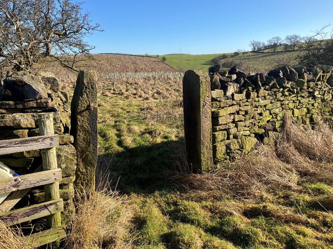
Woodland creation with dry stone wall, Broughton Estate, North Yorkshire © Forestry Commission 2025
Throughout 2024 and 2025 the Worcestershire Historic Environment Record (HER) worked in partnership with the Forestry Commission to deliver an enhanced heritage dataset (known as SHINE) within areas assessed as having ‘Low Sensitivity’ (likely to have fewer sensitivities) for woodland creation in Worcestershire.
SHINE or ‘Selected Heritage Inventory for Natural England’ is a nationally consistent dataset, originally launched by Natural England in 2014, to support land management through agri-environment schemes. Already in use by the Forestry Commission to process Countryside Stewardship Higher Tier (CSHT) applications involving existing woodland, SHINE was identified as the most effective mechanism to deliver a national, consistent heritage dataset which can inform woodland planting proposals.
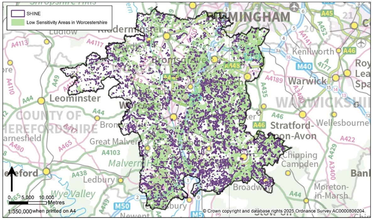
Map showing extent of Low Sensitivity Areas for Woodland Creation (in green) and SHINE records (in purple) in Worcestershire
Throughout the course of 2024 and 2025 the Worcestershire HER team assessed 7422 Monument records held by the HER for their eligibility for inclusion in the SHINE dataset, following which:
- 2181 SHINE records were reviewed
- 863 SHINE records were created
- 852 SHINE records were edited
- 207 SHINE records were revoked
On completion of the Forestry Commission’s funded project, the Worcestershire SHINE dataset totalled 3292 SHINE records, an increase of over 28% from the original evidence base.
The character of heritage assets included within the SHINE dataset varies considerably from the earthworks of ridge and furrow field systems to below ground enclosures associated with prehistoric settlement, parkland landscapes, remnant traditional orchards and WWII defences.
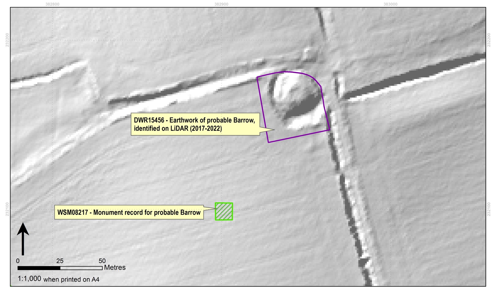
Mapped Monument record (in green) and SHINE record (in purple) of earthwork of probable barrow. Originally recorded on the Sites and Monuments Record in 1988, and more accurately located in the SHINE dataset through use of Environment Agency LiDAR
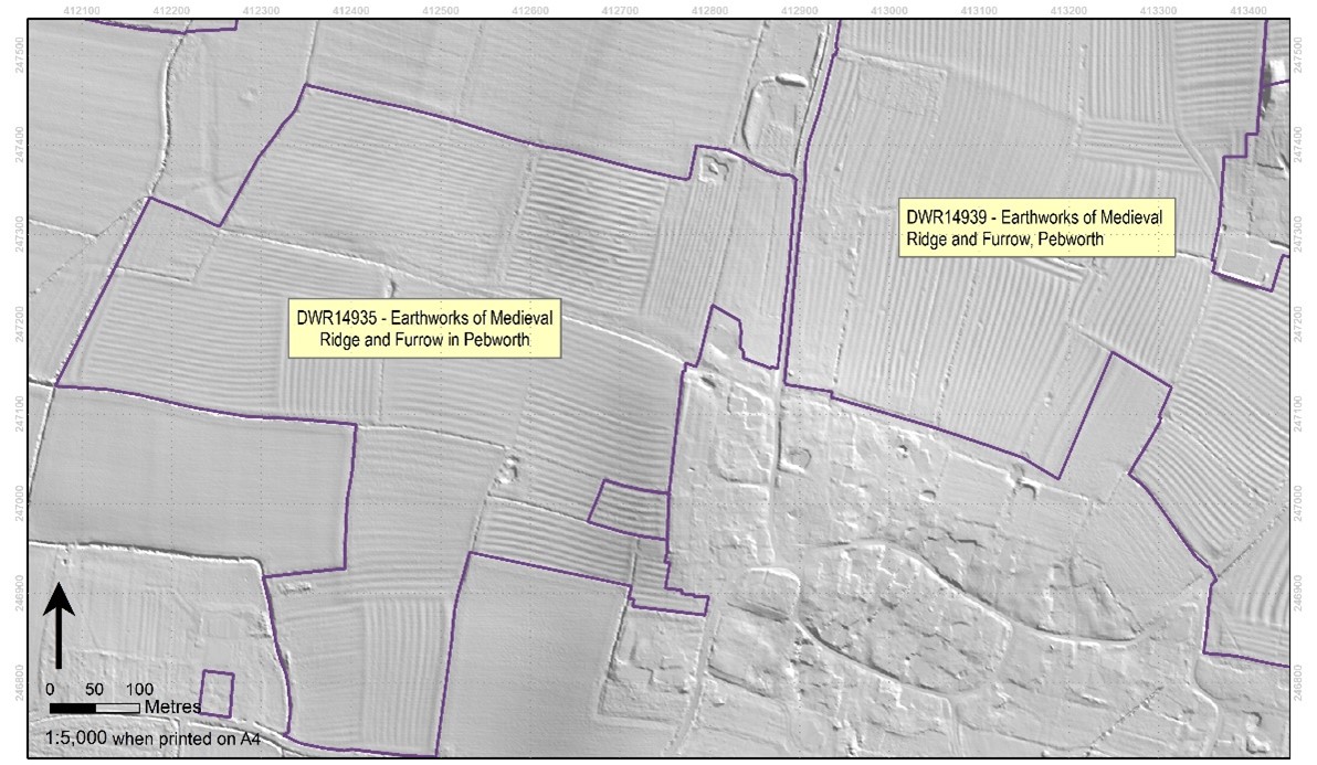
Mapped SHINE record (in purple) of earthworks of ridge and furrow field systems in Pebworth, identified on Environment Agency LiDAR
Through partnership with the Forestry Commission, the Worcestershire Historic Environment Record has been able to enhance SHINE records in Low Sensitivity Areas for woodland creation (covering approximately 40% of the county’s land area).
As well as informing applications for new woodland in the county, the enhanced SHINE evidence-base will also benefit farmers, land managers and agents applying for agri-environment schemes. Although SHINE is not a definitive dataset it remains an important resource for the delivery of well-balanced environmental benefits that preserve the past as part of a sustainable future.

Post a Comment