Ridge and furrow earthworks in Worcestershire
- 27th November 2018
Ridge and furrow earthworks, the remains of former field systems, exist across Worcestershire. They are often overlaid by the straight boundaries of later inclosed fields and form an important part of the landscape character in Worcestershire and the identity of local areas. The pressure for land for development and changes in agriculture in the second half of the 20th century has meant that a lot of these earthworks have been lost. These, shown below, are in Childswickham and are very well preserved.
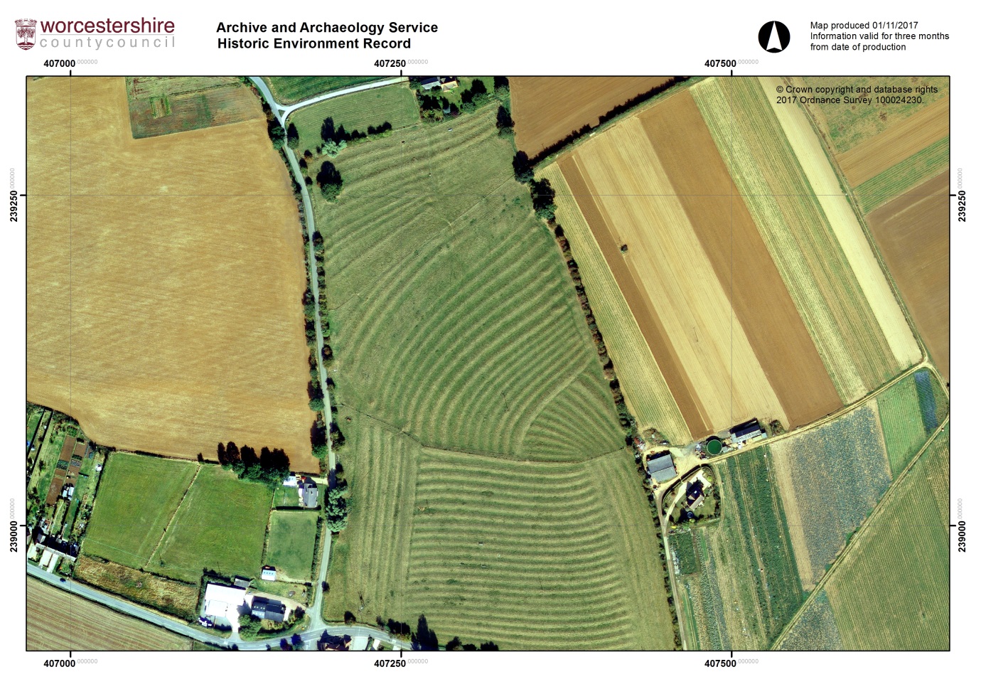
Figure 1: Well preserved ridge and furrow earthworks in Childswickham
A project to assess and record the condition and survival of these earthworks has recently been completed across 64 parishes in Worcestershire. The draft report has been submitted to Historic England and, as soon as this is finalised, it will be added to the Historic Environment Record (HER).
The starting point for this project was the results of an earthwork survey that has been carried out by volunteers since 1997. The 64 parishes are the ones already completed in this earthwork survey, so that we have survey notes and information recorded about the state of the earthworks. This has provided a very important resource for the remaining earthworks in the County. It is still ongoing; using the same tried and tested methods since the start. More information about this can be obtained by contacting the Worcestershire HER.
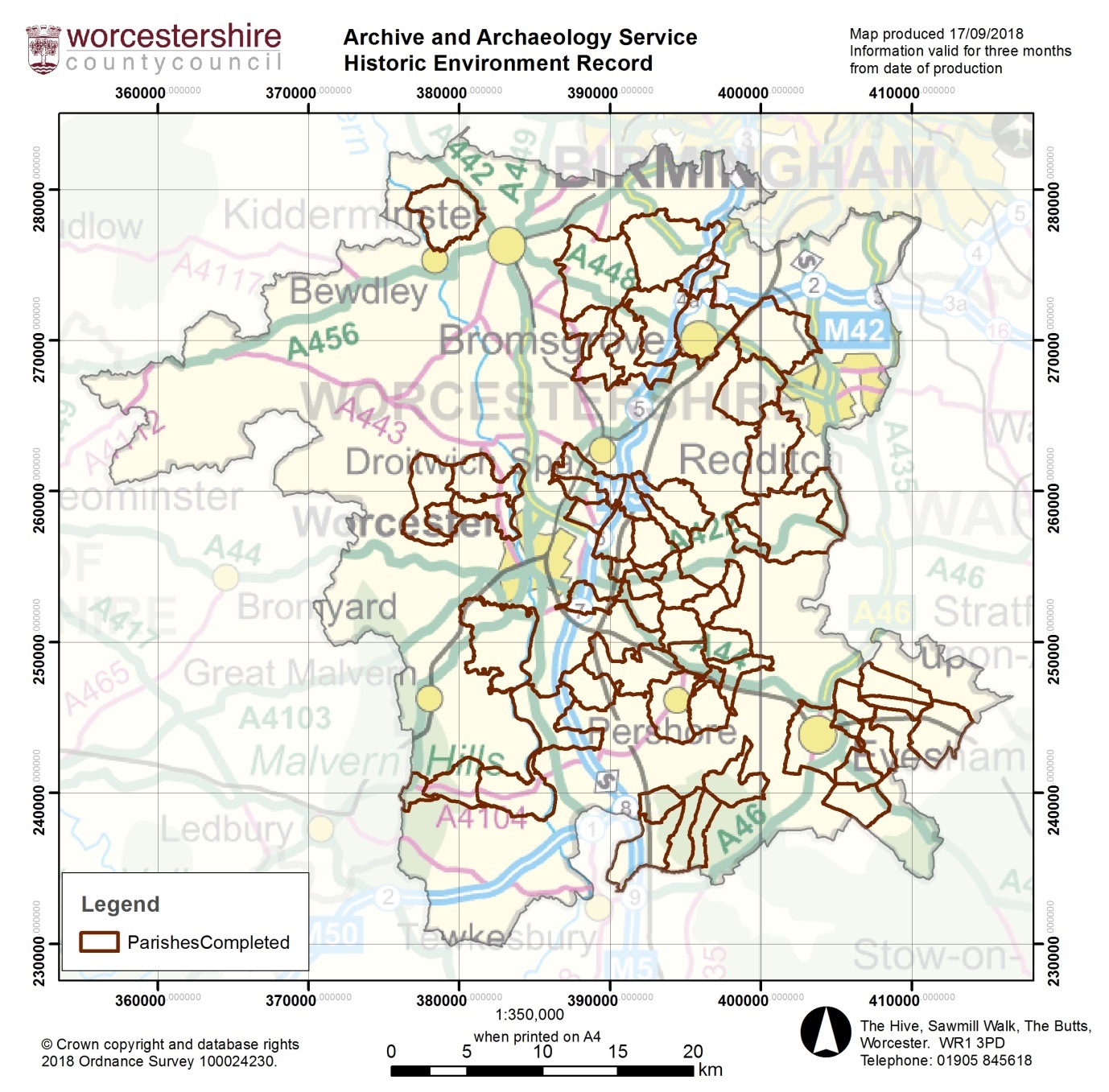
Figure 2: Project Study area – 64 parishes in Worcestershire
The 64 completed parishes included in both projects are shown in the map above. The condition assessment project looked at all the HER records created by the earthwork survey as well as all existing records for ridge and furrow in these parishes.
More volunteers were recruited, trained and a desk based assessment of the earthworks was carried out using LiDAR coverage and aerial photographs to try and establish the condition of the earthworks, the most recent land use and their form. Historic mapping was also used to see whether the land had been used as an orchard in the past, which may have made use of existing, or created new, ridges on which trees were planted. Historic maps also help to work out when the field layout might have changed. The condition of the earthworks and any relevant comments were recorded in the database.
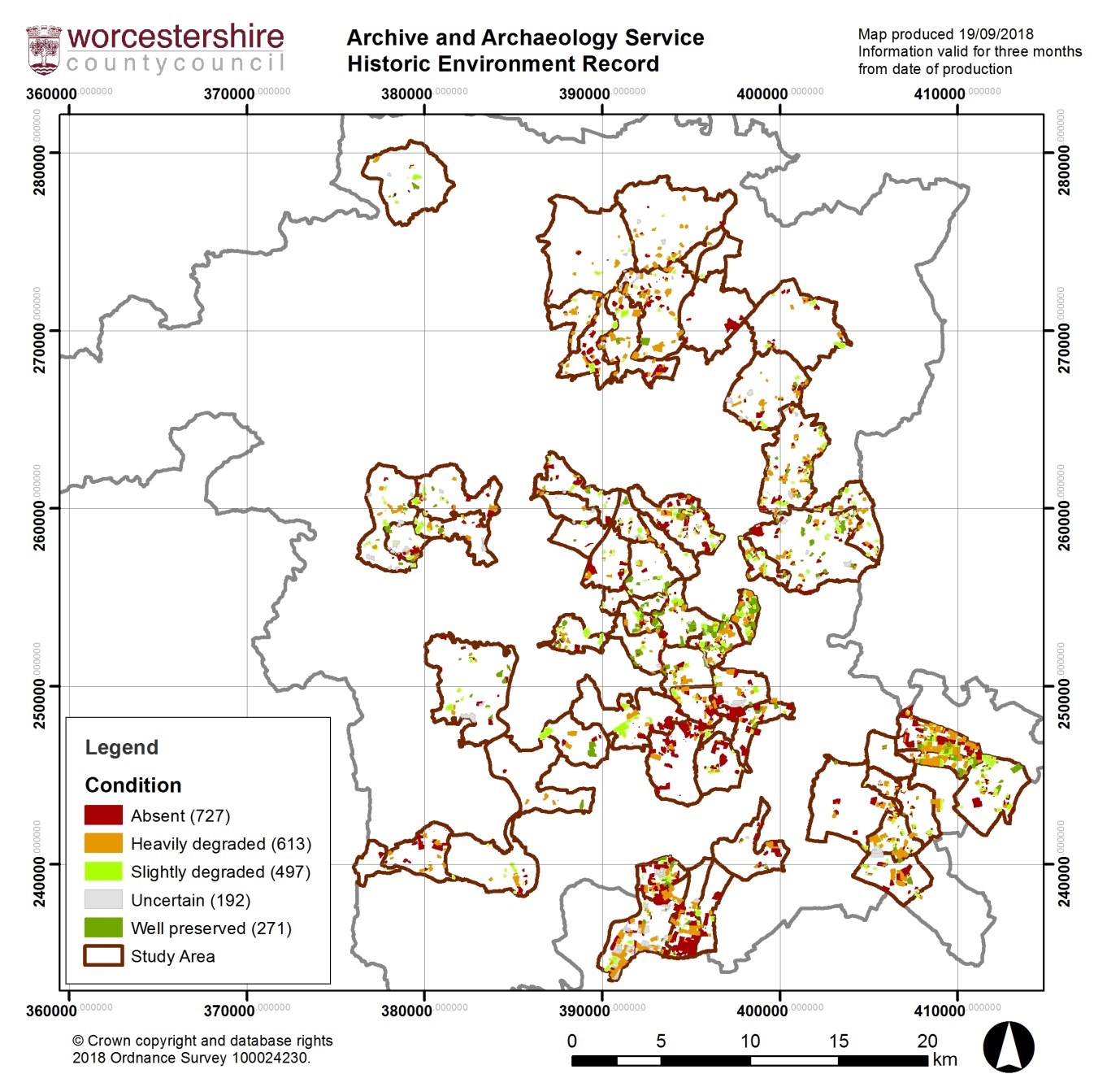
This was not a detailed survey, with no site visits or any other means of investigation, only the layers available through the Geographical Information System (GIS). There were 1607 records for ridge and furrow in these parishes and these produced 2300 records recording the current condition.
The results of the condition assessment are shown below and indicate that a large percentage of ridge and furrow earthworks have been lost since the records on the HER were created (ranging from the 1960s to more recently).
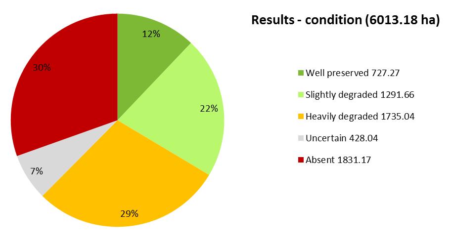
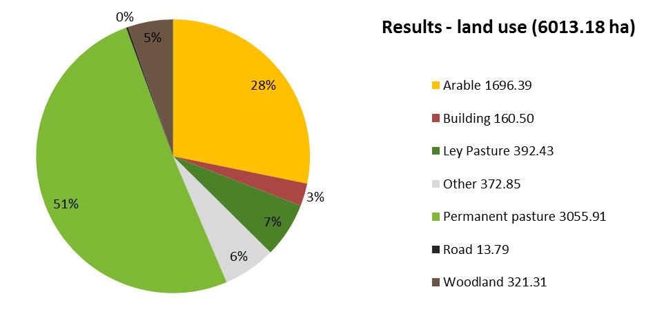
The main pressures that are causing the disappearance of earthworks are arable agriculture and development, even though the latter only made up a small proportion of the land included in the study area. On 98% land in arable use the earthworks were classed as absent, heavily degraded or uncertain, whereas on land which had been developed this was 100%. Other land uses, such as a landfill site and areas of quarrying have also had an impact but not so extensively. Well managed permanent pasture provides safest environment for earthworks to survive; 55% of earthworks recorded on pasture were classed as well preserved or slightly degraded.
Fuller comparisons and analysis are made in the final report which will be available on our online library as soon as it has been approved by Historic England. We will also be applying to Historic England for a further stage of more detailed investigation. This will look in more detail at specific areas of well preserved earthworks in areas identified as part of this project.
Without the time committed by our volunteers we would not have had the information to get this project started nor the ability to get the assessment done in the time available. We are incredibly grateful for their support.

Post a Comment