German military map of Worcestershire
- 10th October 2017
One of our fascinating recent deposits here at Worcestershire Archive Service is a German map of the county, which was part of the “Sonderausgabe!” or “Special Editions” published between 1937 and 1940. These were copies of the Ordnance Survey half-inch maps, scaled up to 1:100.000 to put them in line with standard German maps issued to their military. As well as upscaling the maps, translations were made of key locations and features. It is interesting to observe the conversion that has been made from the Imperial measurements of the original OS maps to the metric measurements used in Germany. In order to prevent wastage of paper and effort, the series also removed the overlaps found in the OS series and reduced the sea coverage.
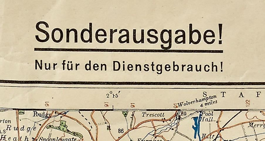
“Special Edition! For Service use only!”
The planned invasion of Britain by Germany in the late 1930s was abandoned in 1940. The preparation for this invasion however started before the outbreak of war in 1939. Gathering of intelligence for an invasion started after a relaxation in 1937 of a previous ban on such activities relating to Britain. One of the outcomes of this intelligence gathering was the production of maps covering Britain, which were designed for military purposes.
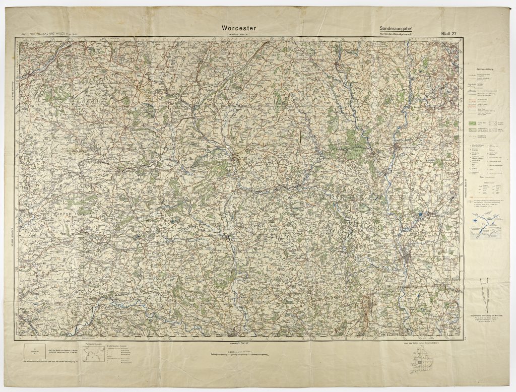
German copy of an OS map of Worcestershire. Item available at reference 899:1948 BA16036.
There is no indication on this map of who produced it, unlike later maps which bare the name of the Generalstab des Heeres, Abteilung für Kriegskarten und Vermessungswesen (sometimes abbreviated as Gen St d H, Abt f Kr Kart u Verm Wes) or other government organisations who were responsible for maps and geographical products. This lack of acknowledgement is probably due to the fact that their production was necessarily secret before the outbreak of war.
The copy we have been gifted has the print code 10.39. which, according to J L Cruikshank, may mean that this is not the original printing. There is no year code provided and the only dating evidence on the map itself is the 1938 magnetic variation diagram and the fact that it uses the 1931 OS map series as its source. The words ‘Nur für den dienstgebraugh!’, which means ‘For Service use only’, are written underneath “Sonderausgabe!” indicating that it was indeed intended for the use of German military personnel.
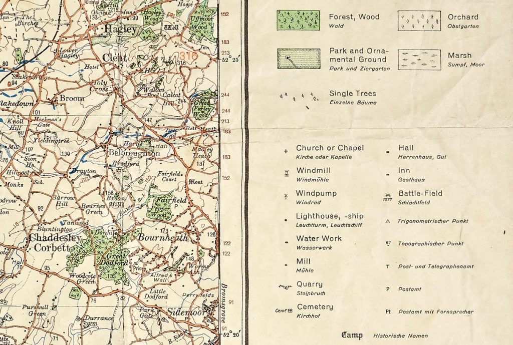
English and German labels for key features of the map
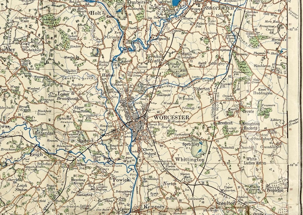
Detail showing the city of Worcester and surrounds.
This map was found amongst the personal belongings of the depositor’s father after he passed away, but we do not know for certain how the map came to be there. His father was in the Home Guard, so it is possible he came across it as part of his duties. Perhaps it could have belonged to a prisoner of war? Or maybe he simply purchased it as a curiosity after the war? Unfortunately we can only speculate. This map was lovingly displayed in our depositor’s home for many years before bringing it to us with the intention that it should continue to be viewed and enjoyed by our researchers. Whilst we may never know the full story of how this particular map came to Britain, the wider purpose of such maps gives us an interesting, and perhaps chilling, insight into the intentions of Nazi Germany towards Britain and the rest of Europe before 1939.
This item has now been repaired and repackaged by our Conservator and is catalogued at reference 899:1948 BA16036. Researchers can view the map by visiting our Original Archive Area during our staffed opening hours.
Suggested further reading
- Anderson, John M.(2001). Forgotten Battles, Forgotten Maps: Resources for Reconstructing Historical Topographical Intelligence Using Army Map Service Materials. Historical Geography Vol. 29 (2001)
- Wheeler, R.C. (2003). German maps of England of World War II and associated publications. Sheetlines, 68 (December 2003) pp.26-31
- Cruickshank, J.L. (2004). German military maps of UK & Ireland of World War II. Sheetlines, 69 (April 2004), pp.15-19

Post a Comment